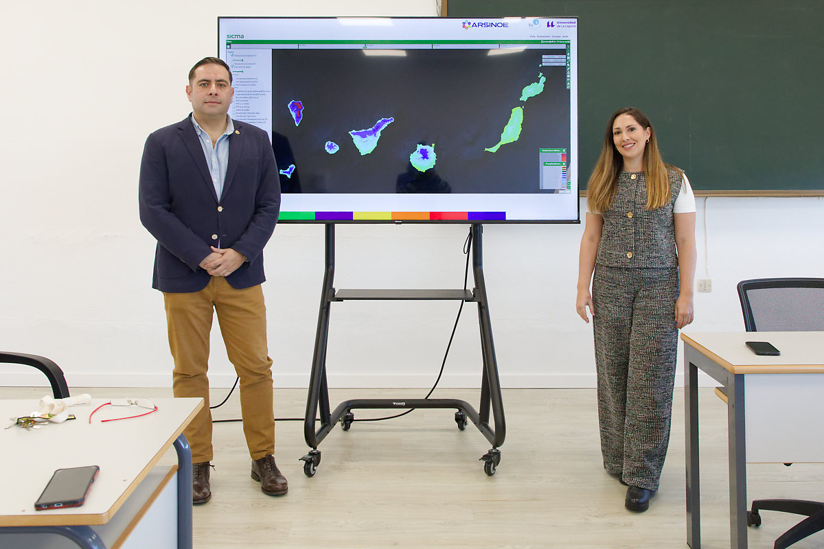
Today, at the Agricultural Engineering Section of the University of La Laguna, the website of Climate and Meteorological Information System SICMA-Canary Islands. This system consists of an open-access platform that allows users to consult current, past, and future weather conditions for the Canary Islands archipelago, with a spatial resolution of 100 meters by 100 meters. This level of detail makes it the most advanced and precise tool of its kind focused on islands in Europe.
The SICMA-Canarias website is a climate GIS platform that emerged as the main result of the open call for innovation of the European project ARSINOE (Climate-resilient regions through systemic solutions and innovations), from the H2020 call, a project led by Professor Juan Carlos Santamarta from the University of La Laguna and which has included the participation of the researcher Noelia Cruz Pérez, who is also a member of the Committee of Experts for the study of climate change of the Government of the Canary Islands.
In addition to the University of La Laguna, prestigious climate organizations such as Meteogrid and the Climate Research Foundation (FIClima) participated in the development of the platform. FIClima specializes in research, innovation, and the development of solutions related to climate change, as well as in the areas of climatology, meteorology, the environment, and development cooperation. FIClima contributed an innovative methodology for developing projections adapted to the complex and unique territory of the Canary Islands. Meteorologist César Paradinas Blázquez led the development team at FIClima.
The variables included in this tool are maximum and minimum temperature, precipitation, potential and actual evapotranspiration, water balance, the SPEI (Standardized Precipitation-Evapotranspiration Index), Aridity Index, and heat waves. Projections have been made for three periods: 2021–2050, 2041–2070, and 2071–2100, and are based on participatory workshops with stakeholders who identified the archipelago's priority needs in areas such as water resources, agriculture, and tourism.
The spatial distribution of the analysis, adapted to the peculiarities of each island, was developed with up to 10 recent climate models from CMIP6 and 4 socioeconomic scenarios (SSPs), from the most optimistic to the most pessimistic, thus allowing the exploration of possible climate futures for the Canary Islands, always taking into account the inherent uncertainty associated with the climate.
This system, aligned with the latest findings of the IPCC (Climate Change Assessment Report, AR6), places the Canary Islands, along with Andalusia, as one of only two regions in Spain with a tool of this magnitude. This advancement is crucial for strategic sectors such as water management, agriculture, and the conservation of the natural environment.
A key tool
The launch of the Canary Islands Climate and Meteorological Information System (SICMA-Canarias) marks a milestone for the Canary Islands, providing an unprecedented strategic tool for the present and future planning and management of essential resources such as water, agriculture, and natural spaces, aligning with the need to promote adaptation to climate change. This innovative system not only provides detailed climate projections up to the year 2100, but also offers information with exceptional spatial accuracy, tailored to the unique microclimatic characteristics of each island. In an archipelago so vulnerable to the impacts of climate change, such as decreased rainfall, aquifer salinization, and the risks associated with heat waves, this platform becomes an indispensable resource for designing policies based on scientific evidence.
The potential of SICMA-Canarias is immense for strategic sectors. Island Water Councils will be able to integrate the data into their hydrological plans, facilitating the protection of aquifers and optimizing the use of water resources. In the agricultural sector, where access to water is crucial for maintaining productivity and sustainability, this tool will allow farmers to anticipate adverse climate scenarios, ensuring more resilient practices. Meanwhile, managers of National Parks and protected areas will have a robust scientific foundation for implementing conservation and adaptation strategies in the unique ecosystems of the Canary Islands, safeguarding their biodiversity in the face of future climate change scenarios.
The creation of SICMA-Canarias not only reinforces the Canary Islands' role as a leader in regional climate research, but also positions the archipelago as a model of climate innovation at the European level. Thanks to the support of the ARSINOE project and the collaboration of entities such as the Climate Research Foundation and Meteogrid, this tool puts the Canary Islands on the map of regions with the most information to address climate change. The ability to consult open and highly accurate data not only benefits policymakers and scientists, but also fosters public awareness and participation in this global challenge.
With this platform, the Government of the Canary Islands and local institutions have a unique tool at their disposal for making informed decisions that balance economic development with the preservation of natural resources. The main results of the climate projections have been submitted to internationally renowned scientific journals for peer review and subsequent publication, thus securing the endorsement of the scientific community for the research conducted.
ARSINOE
ARSINOE is an international project with a total of 41 participating partners and €15.5 million in direct funding from the European Union's Horizon 2020 program. Running for 48 months, the project concludes in October 2025. During the project, nine case studies were developed in different regions of Europe.
The University of La Laguna has led the project for the past three years. Focused on climate and water resource research in the Canary Islands, it has placed particular emphasis on the islands of El Hierro and La Palma, with special attention to the Tajogaite eruption, which coincided with the start of the project.
In the case of the Canary Islands, work has been carried out on the aquifers of La Palma and El Hierro, resulting in various studies in collaboration with the IGME-CSIC (Spanish Geological Survey - Spanish National Research Council). These studies include the impact of the Tajogaite volcano eruption on groundwater resources and the detection of microplastics and emerging contaminants in the groundwater of El Hierro and La Palma—pioneering studies in their field. Finally, new hydrogeological models of both islands and their evolution have been developed, considering different future climate change scenarios created on the platform. A total of 16 studies have been published in leading scientific journals.
The platform is open access and can be viewed at the following link: https://canarias.sicma.red/

 Spanish
 English
 French